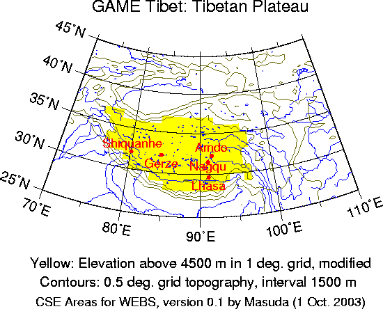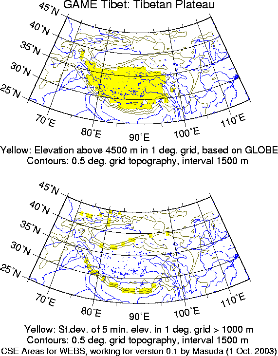

The area of GAME Tibet is not a major river basin. Water balance is studied in some mesoscale (in meteorologists' sense) catchments much smaller than the plateau scale. I made a 1-degree elevation data by taking spatial averages of U.S. National Geophysical Data Center (NGDC)'s GLOBE 30-second elevation data. It seems that the area with elevation above 4500 m almost corresponds to the concept of the plateau (see the upper panel of the figure below). I filled a hole and removed isolated parts. The boundary of this region is relatively steep slope. For the purpose of atmospheric energy and water balance, this characteristics is not desirable. I checked the standard deviation of the elevation (actually standard deviation of 5-minute average height in 1-degree boxes), and found that those boxes with the standard deviation larger than 1000 m (see the lower panel of the figure below) is not included in the region defined this way. Still it might be better to trim southwestern and northwestern edges (Himalaya and Kunlun mountain ranges) somewhat.
