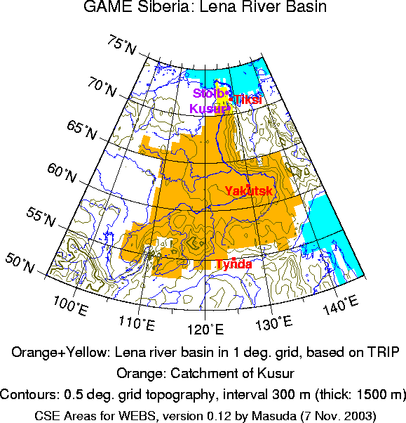

The area of GAME Siberia in this template is the Lena river basin as defined in the 1-degree version of TRIP (orange plus yellow areas in the map). The orange area in the map is the catchment of the river discharge station Kusur [It may be better spelled "Kyusyur"].
There is another station "Stolb" below Kusur, but the discharge at Stolb in June (the peak month of runoff) is actually smaller than at Kusur. There is no significant difference in other months. Stolb is in the delta and it seems that natural diversion to another route occurs at high water level.
Actually, intensive observations were concentrated at three subregions and two of them (Tiksi and Tynda) are slightly out of the catchment. Also, it seems that no significant studies have been conducted for the whole basin with regional rather than global data sets or models. But, because such studies are intended, and because GAME Siberia should be compared with MAGS among others, I made like this.