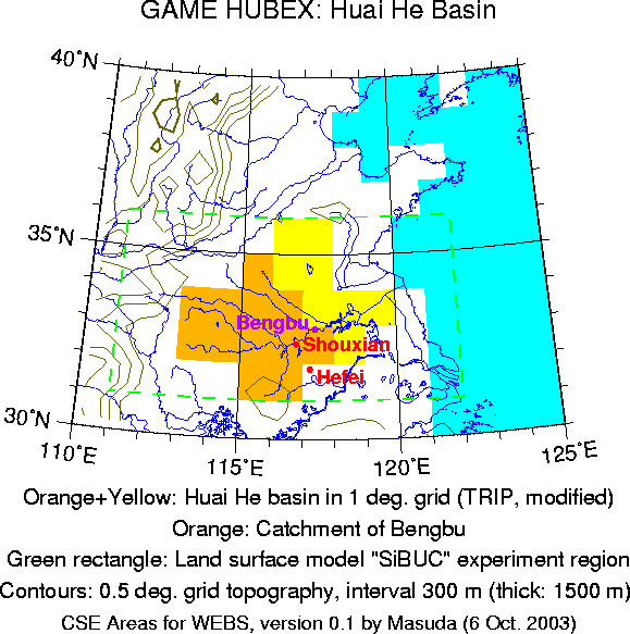

The area of GAME HUBEX in this template is the Huai He basin as defined in the 1-degree version of TRIP (orange plus yellow areas in the map) [He = river in northern Chinese]. The basin as calculated with TRIP data had a grid box at the coast which was only diagonally connected to other boxes. I removed it by subjective decision. The orange area in the map is the catchment of the river discharge station Bengbu.
As far as I know, discharge of the mainstream is observed at Bengbu near the middle of the area, so the water balance of the lower half cannot be discussed with observed discharge. I do not want to make the area further smaller, however. Also, in this region human intervention to water seems so strong that the boundary of natural river catchments may not be so important.
An alternative definition is the rectangle (drawn by green line in map) where Kenji Tanaka (Kyoto Univ.) conducted land surface model experiments: 31 - 36 N, 111 - 122 E. (This rectangle includes some sea surface which should be removed.)