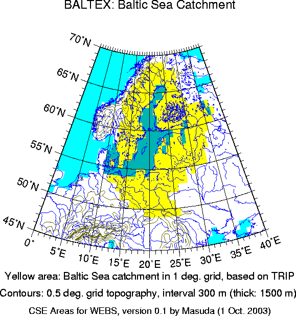

The BALTEX region is the catchment of rivers which run to the Baltic Sea. Though BALTEX includes experimental observations over the sea, this template includes only grid boxes that are defined as land. In this template, it was determined with 1-degree version of TRIP and some trial and error. The target of my trial and error was a rough agreement with the Baltic Sea catchment in 0.5 degree grid as used at Max Planck Institute (Hagemann, S. et al., 2002: Intercomparison of water and energy budgets simulated by regional climate models applied over Europe. Max Planck Institute for Meteorology Report No. 338, 45 pp.). The agreement is just crude and not detailed.